
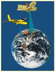
REMOTE SENSING AND ITS APPLICATIONS
Remote Sensing can be defined as obtaining information about an object by observing it from a distance and without coming into actual contact with it. Example: Eye sight, Photos taken from a camera. In general, the word remote sensing is used for data collection from artificial satellites orbiting the earth and processing such data to make useful decisions. Hence, remote sensing can also be defined as the science and art of collecting information about an object, area or phenomenon from a far-off place without coming in contact with it.
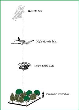
The satellite remote sensing system consists of,
- Space segment
- Sensor system
- Ground segment.
Space Segment : The space segment consists of the satellites orbiting the earth at a very high attitude.
Eg: IRS-1A is launched to an attitude of 904 km and orbits the earth in North-South direction.
Sensor system : Sensors are instruments which sense the objects on the surface of the earth and records them. The sensors mounted on satellites (called scanners) scans the objects on the surface of the earth. A set of consecutive scan lines forms an image, which is sent back to the earth receiving stations called ground segments.
Ground Segment : They are the stations put up on the ground surface to receive the signals sent from remote sensing satellites. The signals received from the satellites are converted to images and stored in digital format. The images are to be processed to retrieve useful information. This process is called Image Processing.

The light energy (Electro Magnetic Waves) falling on the ground surface is partly,
- Absorbed,
- Scattered,
- Transmitted,
- Reflected.
Since, different objects on the ground have different properties of absorbing, scattering, transmitting and reflecting the energy, the images formed due to reflected energy waves will be different for different objects. Hence, a correlation is made between the images developed and the corresponding objects on the ground (Ground Truth). Thereafter, such information is used to interpret the images directly for making useful decisions.
Remote Sensing Applications
1. Weather forecasting:
Remote sensing is extensively used in India for weather forecasting. It is also used to warn people about impending cyclones.
2. Environmental Study
It can be used to study deforestation, degradation of fertile lands, pollution in atmosphere, desertification, eutrophication of large water bodies and oil spillage from oil tankers.
3. Natural hazards study
Remote sensing can be used to study damages caused by earthquakes, volcanoes, land slides, floods and melting of ice in polar regions. Many times remote sensing will be helpful to predict the occurrence of natural hazards.
4. Resource exploration
Remote sensing data is helpful for updating existing geological maps, rapid preparation of lineament and tectonic maps, identifying the sites for quarrying the minerals and helpful in locating fossil fuel deposits.
5. Land use mapping
Remote sensing data is useful in obtaining up-to-date land use pattern of large areas at any given time and also monitor changes that occur from time to time. This information is used by regional planners and administrators to frame policy matters for all round development of the region.